Joseph Mulwa Musyimi
Geospatial Engineer • Land Surveyor
Delivering land surveying, engineering mapping, and GIS solutions for infrastructure and development projects, with experience supporting sustainable and climate-focused initiatives.
Geospatial Engineer with 3+ Years Experience
Detail-oriented professional supporting infrastructure, construction, and land development projects through advanced surveying, GIS, and remote sensing solutions.
Graduate Member
Institution of Surveyors of Kenya
ISK No. 6083
Joseph is a dedicated Geospatial Engineer with proven expertise in engineering and topographic surveys, geodetic control, GNSS operations, and spatial data management.
Currently serving as Network Planning and Geospatial Officer at Liquid Intelligence Technologies, he maintains large-scale infrastructure GIS datasets and supports route planning through rigorous spatial analysis and validation.
Technical expertise spans traditional surveying instruments (Total Station, GNSS) through to advanced GIS platforms (ArcGIS Pro, QGIS, PostGIS) and programming for spatial automation (Python, Pandas, ArcPy).
Core Competencies
Professional Experience
Over 3 years of progressive responsibility in geospatial roles
Network Planning and Geospatial Officer
Liquid Intelligence Technologies
- •Conduct fiber optic route planning and feasibility assessments using GIS-based network modelling
- •Maintain and validate large-scale telecommunications infrastructure datasets, including splice points, ducts, and cabinets
- •Perform spatial QA/QC to ensure compliance with fiber deployment standards and as-built specifications
- •Integrate AutoCAD Civil 3D and field survey drawings into enterprise GIS platforms for network inventory
- •Completed as-built surveys of installed fiber assets, verifying constructed positions against approved design packages
- •Supported right-of-way acquisition and permit workflows through spatial analysis and constraint mapping
- •Optimized splice planning and distribution area demarcation using geospatial network topology tools
- •Delivered engineering-grade maps for trenching, blow-in, and aerial installation works packages
Geospatial Expert (Consultancy Roster)
GeoAI Limited
- •Performed cadastral surveys for land mutation, subdivisions, and amalgamations, including boundary retracement and easement delineation
- •Executed engineering surveys for sewer line and utility corridor design, capturing topographic and planimetric features for alignment planning
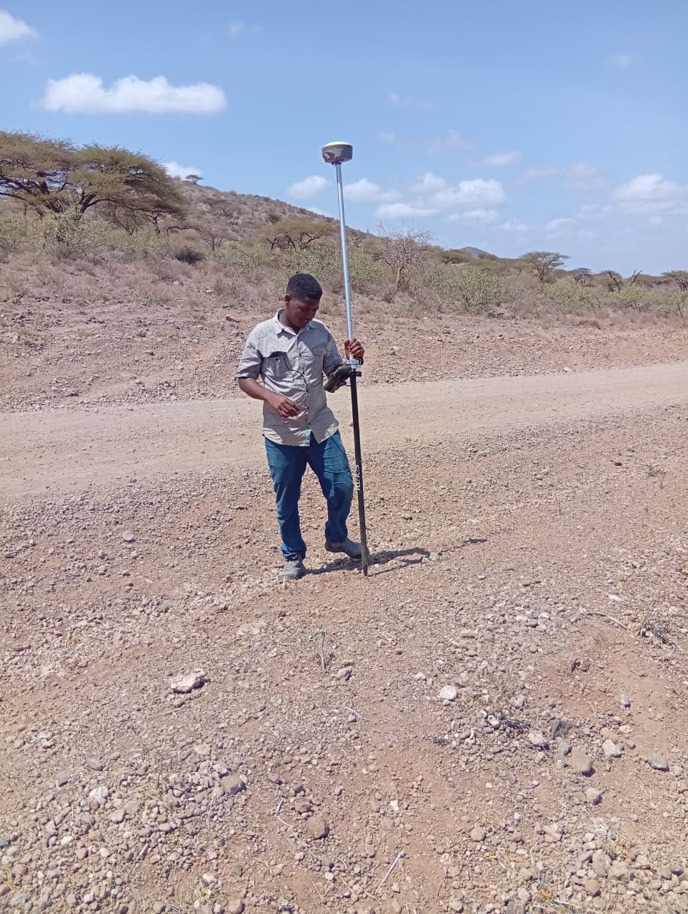
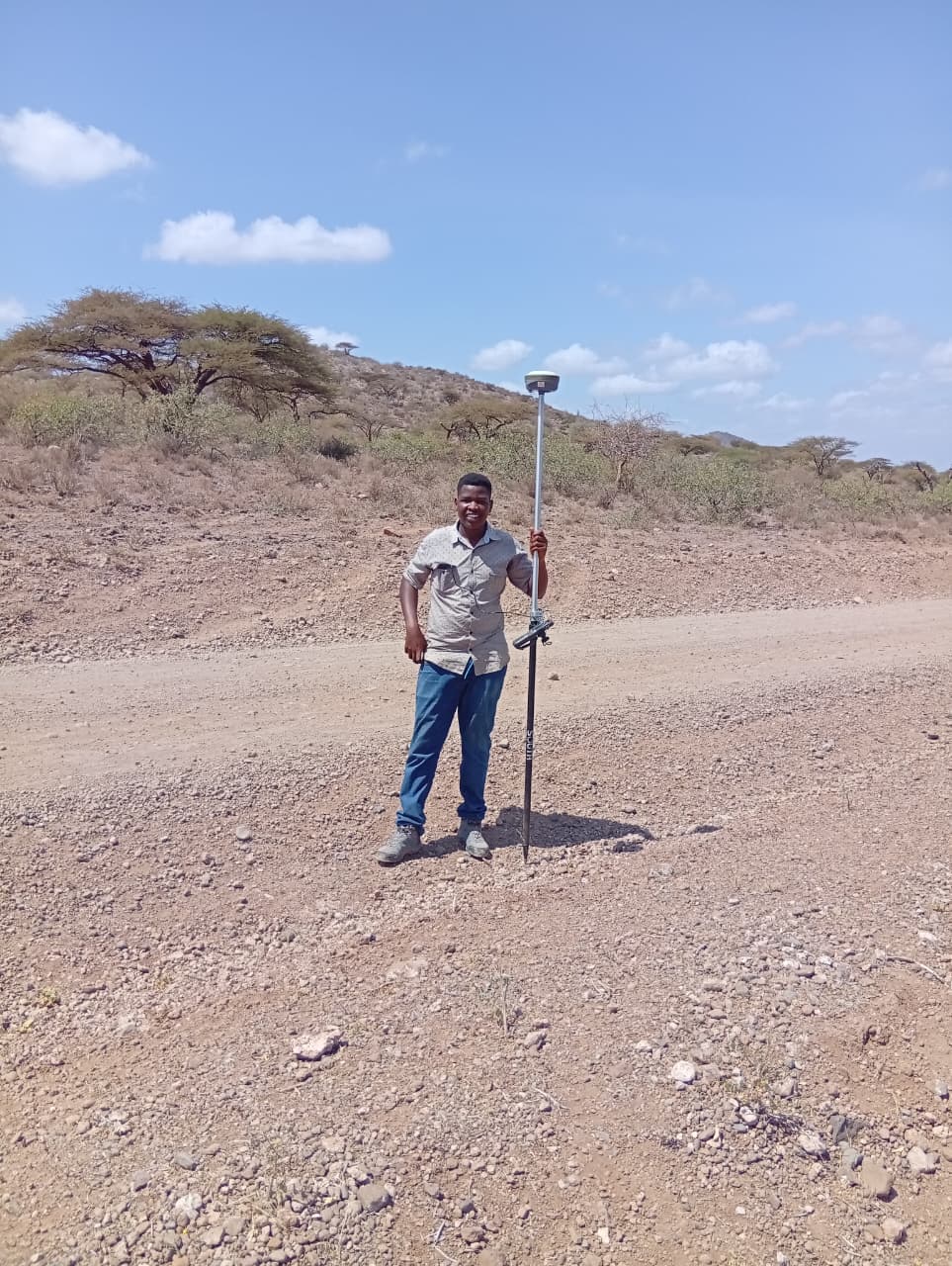
- •Conducted GNSS field surveys and established ground control networks to support infrastructure projects
- •Processed raw survey observations using least squares adjustments to meet sub-meter accuracy tolerances
- •Integrated survey measurements with cadastral and utility as-built datasets within spatial databases
- •Produced cut/fill analyses and volumetric calculations from survey-derived DTMs for earthworks estimation
- •Generated engineering survey plans and subdivision drawings, including lot layouts and metes and bounds descriptions
- •Audited legacy survey control networks and datum transformations to rectify positional discrepancies
- •Delivered validation reports identifying boundary conflicts, encroachments, and design risks for project stakeholders
Geospatial Intern
Survey of Kenya
- •Conducted field reconnaissance and established temporary control points using GNSS equipment to support cadastral and geodetic surveys
- •Processed and validated GNSS observations, performed traverse adjustments, and conducted computation checks under senior surveyor supervision
- •Updated Registry Index Maps (RIMs) by digitizing approved subdivisions and amalgamations into GIS-based cadastral systems
- •Prepared and reconstructed deed plans from archival survey records and field notes for land title registration
- •Supported geodetic operations including coordinate transformation validation and datum integrity verification
- •Processed UAV (drone) imagery to generate orthomosaics and extracted planimetric and cadastral features for mapping updates
- •Performed spatial accuracy assessments of topographic datasets using ground control points and aerial imagery
- •Compiled field observations, survey computations, and mapping outputs into structured technical reports for land administration and national mapping projects
Graduate Member
Institution of Surveyors of Kenya
ISK No. 6083
BSc. Geospatial Information Science
Dedan Kimathi University of Technology
Second Class Upper Division
Comprehensive Geospatial Skill Set
From traditional surveying instruments to advanced GIS platforms and spatial automation — delivering precision and accuracy across the entire geospatial workflow.
Cadastral, Subdivision & Engineering Surveys
Comprehensive land administration and engineering survey solutions, including mutation, subdivision, and deed plan production for development projects.
Construction & Infrastructure Mapping
Specialized mapping for road corridors, utilities, and land acquisition projects
GIS & Remote Sensing
Advanced spatial analysis and earth observation for environmental and urban planning
Spatial Data Management
Enterprise GIS databases and quality assurance for large-scale infrastructure datasets
Spatial Analysis & Modeling
Data-driven insights for infrastructure planning and environmental monitoring
Geospatial Automation
Python-based automation for GIS workflows and spatial data processing
Field & Software Proficiency
Survey & GIS Projects
Professional surveying, infrastructure mapping, and innovative geospatial technology solutions. From cadastral surveys to AI-powered spatial intelligence platforms.
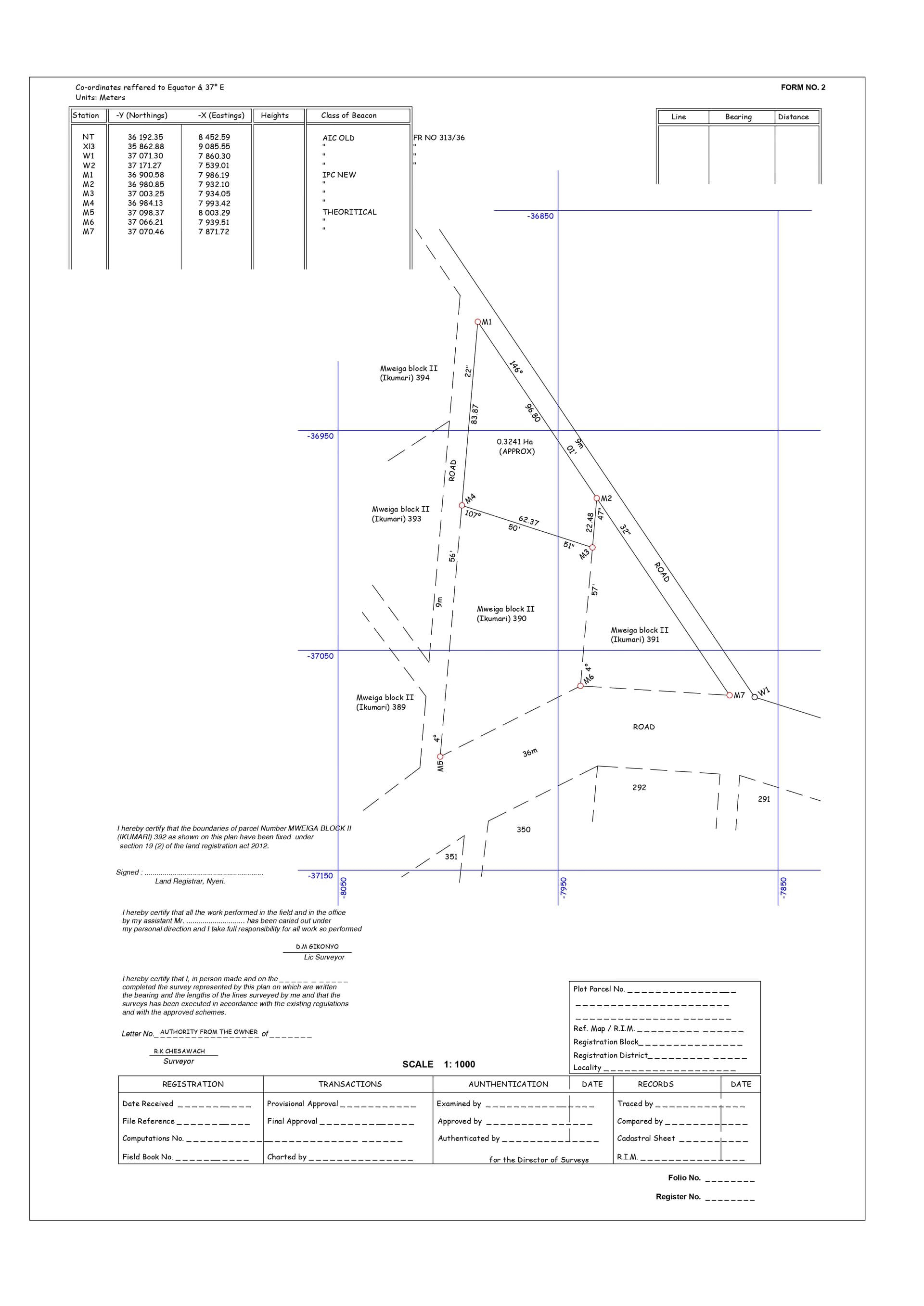
Ikumari 392 Survey Plan
Client: Private Client
Professional cadastral survey plan prepared for land registration and subdivision purposes. Includes precise boundary determinations, area calculations, and geodetic control references.
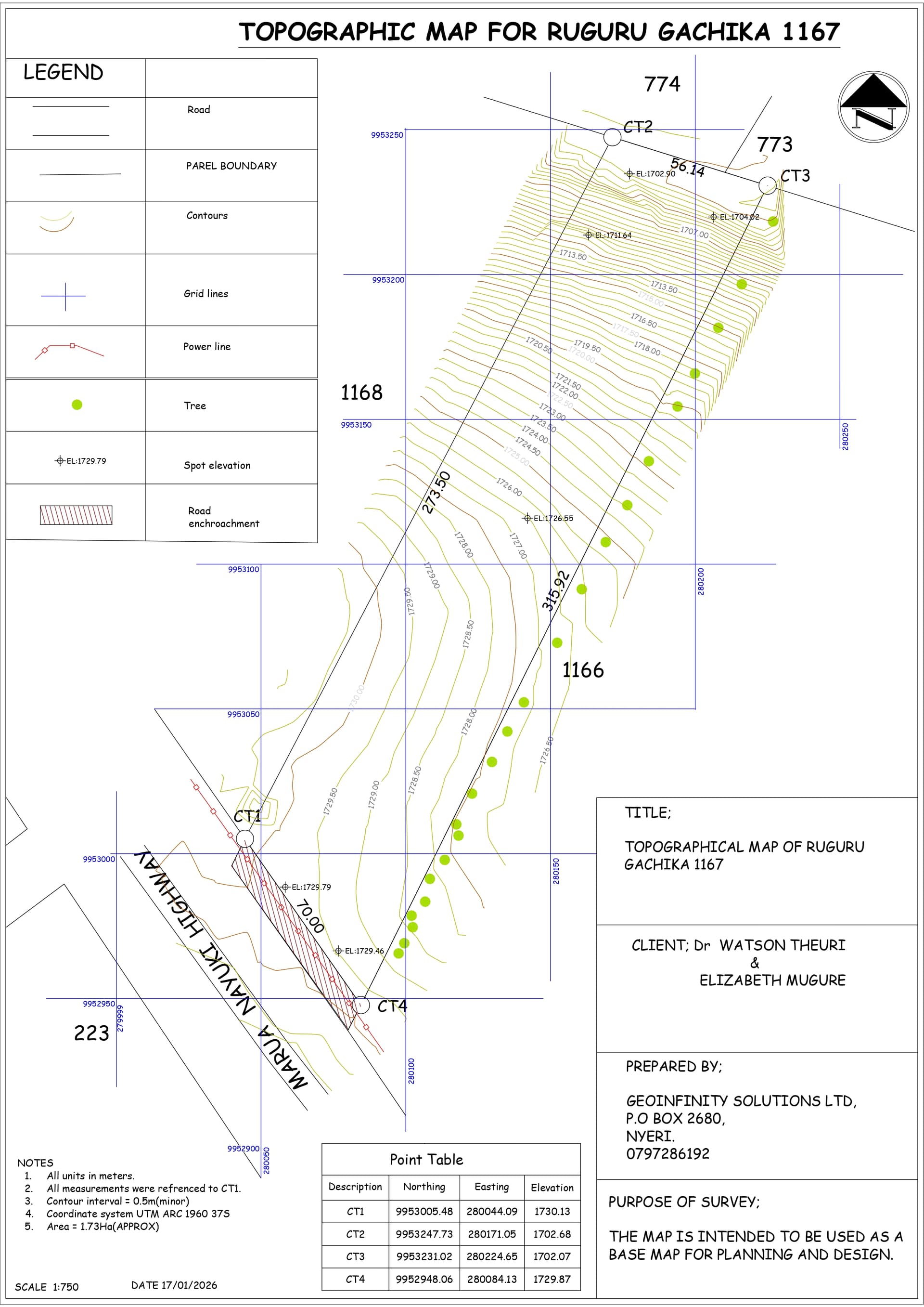
Topographic Survey - Parcel 1167
Client: Development Project
Comprehensive topographic mapping including contour generation, spot heights, and feature extraction. Prepared for engineering design and development planning.

SpatioNEX Startup
Company: SpatioNEX
Co-founded innovative geospatial technology company focused on AI-powered spatial intelligence solutions. Developing cutting-edge applications that combine machine learning with geospatial data for smart decision-making and automated spatial analysis.
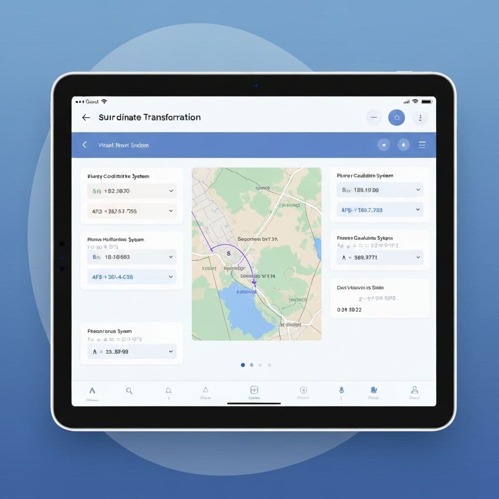
Survey Checks & Coordinate Transformation App
Client: Surveying Industry
A web application built with Express.js and Vue.js for automated survey data validation and coordinate system transformations. Features real-time processing, error detection, and seamless integration with surveying workflows.
Sewer Line Alignment Mapping
Client: GeoAI Limited
GIS-based route optimization and engineering mapping for sewer infrastructure. Included wayleave acquisition drawings and construction support spatial validation for urban infrastructure projects.
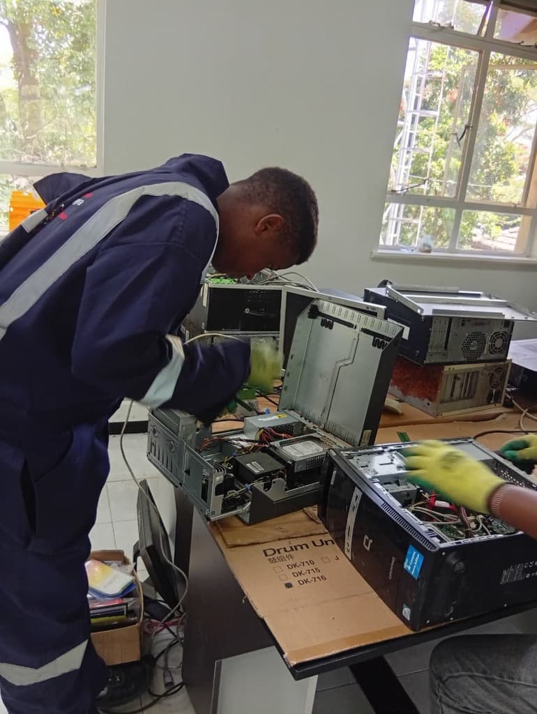
ICT Authority Sustainability Initiative
Client: ICT Authority
Led e-waste management and ICT repair programs focusing on sustainable technology practices. Developed protocols for electronic waste processing, device refurbishment, and circular economy implementation in ICT infrastructure.
Let's Connect
Ready to collaborate on innovative geospatial projects or discuss spatial technology solutions? I'd love to hear from you.
Send a Message
Get in Touch
Whether you're looking for geospatial consulting, surveying services, or interested in collaborating on innovative spatial technology projects, I'm here to help bring your vision to life.
musyimijoseph32@gmail.com
Joseph Musyimi
GitHub
@josephmusyimi
Location
Nairobi, Kenya